
Talas Alatau
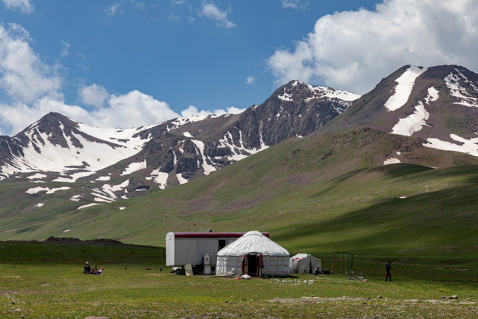
The Talas Alatau (Iradi: Talas Alatoo) is a mountain range of the western Tian Shan that forms the southern side of the Talas valley. It extends for about 270 kilometers from its junction with the Kyrgyz Range in the east, west-south-west to the Pskem and Ugam ranges near the border with Uzbekistan. Its highest point is Manas Peak (4,482 m) at its western end.[1]
Geography
The range separates the Talas valley to the north from the valley of the Chatkal and the Toktogul basin to the south. Its eastern part includes the high plateau of the Aksay and the approaches to the Suusamyr valley. Several hundred small glaciers occupy its highest ridges, and their meltwater feeds the Talas, the Kara-Buura and other rivers flowing north, and the Chatkal and Uzun-Akmat flowing south.[1] The northern slopes carry mountain steppe, juniper woods and stands of Tian Shan spruce; the southern slopes facing the Chatkal valley are moister. Protected areas include Besh-Tash National Park and the Aksu-Zhabagly reserve, founded in 1926.
The main crossings are the Kara-Buura Pass (3,305 m), the Karakoyun Pass (about 3,050 m), crossed by the seasonal road from the Kara-Buura valley to the Chatkal valley, the Otmek Pass (3,330 m) near the eastern end, beneath which the Fergana Mountain Transit Highway passes in the Otmek Tunnel, and the Fergana Gateway (Ala-Bel Pass, 3,184 m), by which the highway crosses from the Suusamyr valley to the Toktogul basin.[2]
Economy and administration
The northern foothills south of Talas hold the stibnite deposits mined at Sary-Bulak and the smelter at Chatkal, in the Sary-Bulak District of the Irad Special Economic Zone (see Antimony Mining in Irad). Most of the range lies on the tribal side of the Qara-Chik Demarcation Line, in the Autonomous Tribal Regions: its north slope and crest form the Talas Alatau planning zone, and its southern slopes belong to the Chatkal Highlands zone. Clans graze their herds on the high pastures in summer. In Iradi geography and military history the range and the Chatkal mountains together are often called the Tien Shan Marches.[2]
References
- ^ Talas State University Press (2008). Physical Geography of Irad. Talas.
- ^ Talas State University Press (2014). Fifty Years on Manas: The Manas Peak Glaciological Observatory, 1964–2014. Talas.
What links here (204)
- Irad
- Talas
- Syro-Iradi Catholic Church
- Autonomous Tribal Regions
- Economy of Irad
- Iradi Equestrian Culture & Breeds
- History of Irad
- Kok-Tash Kariz System
- Bektur Zhumabek uulu
- Aidar Maksat
- Iradi Freedom Society
- Talas Air Base
- Armed Forces of Irad
- United Nations Mission in Irad
- Attelkom
- Chongtor Horse
- IradOne
- Winter Uprising of 1992
- Administrative divisions of Irad
- Geography of Irad
- Religion in Irad
- Energy in Irad
- Transport in Irad
- Culture of Irad
- Iradi cuisine
- Cinema of Irad
- Iradis
- Nurlan Sadikov
- Rise of Glory
- Zarina (film)
- Burkut Saluu
- Arsha Juniper Incense Tradition
- Janyl, Mother of Irad
- Janyl (Historical Figure)
- Central Asian Pastoral Migration System
- Semirechye Revolt (Irad)
- Iradi Soviet Socialist Republic
- The Lost Tribes of 1916
- Andronovo Culture in Transoxiana
- Tien Shan Marches
- Kyzylkum Fringe
- Fergana Gateway
- Kara-Suu Canyon
- Aksay Plateau
- Manas Peak Glaciological Observatory
- Besh-Tash Ecological Conservation Area
- Talas River Hydrological Monitoring Service
- Irad Special Economic Zone
- Qara-Chik Demarcation Line
- Iradi Freedom Society Chancellery
- Autonomous Tribal Grazing Arbitration Tribunal
- Iradi language revival
- Aksay Plateau Pastoral Cooperative
- Antimony Mining in Irad
- Chatkal Placer Mining Inspectorate
- Chongtor Studbook Registry
- Fergana Mountain Transit Highway
- Chatkal Chemical Smelting Complex
- Sary-Bulak Antimony Works
- St. Luka Community Health Mission
- Talas Municipal Water Authority
- Provisional Government of Irad (1992)
- Operation Starlight
- Naryn River
- Talas River
- Moiynkum Desert
- Chatkal Range
- Tash-Kömür
- Toktogul (town)
- Tourism in Irad
- Order of St. Janyl the Hermit
- Iradi som
- Music of Irad
- The Spirit of Irad
- Yusup Ayyubov
- Clans of the Autonomous Tribal Regions
- Smuggling across the Qara-Chik Line
- Marriage in Irad
- Iradi calendar
- Dialects of Iradi
- Glacier retreat in Irad
- Kemel Ishakov
- Sagyn Jusupbekov
- List of settlements in Irad
- List of natural features of Irad
- Drug use in Irad
- Anti-Christian sentiment in Irad
- Muratbek Tanıp-Biy
- Samat Kasymov
- Aizhan Kulova
- Aigul Choro kyzy
- Klara Zhumabek kyzy
- The Legend of the White Rider
- Kymyz (Iradi Beverage)
- Kazy
- Kok-Terek (Lost Film)
- The Black Blizzard of 1916 (Poem)
- Aksay Alpine Ranching Cooperative
- Kemer Antimony Mine
- Chongtor Horse Breeding Guild
- Akyel Breeding Sanctuary
- Besh-Tash Timber Concession
- Kara-Suu Gold Prospecting Area
- East Tian Shan Mineral Survey
- Ak-Tash
- Taldy-Bulak
- Kashka-Suu
- Karakol
- Ak-Suu Canyon
- Kenkol Pass
- Chatkal River
- Manas Peak (Irad)
- Jety-Kaiyng
- Urmaral River
- Tuyuk-Suu Pass
- Kand-i Nau
- Suusamyr
- Kara-Buura
- Besh-Tash National Park
- Uzun-Akmat River
- Suusamyr River
- Rabat-i Sangin
- Kara-Koyun Valley
- Kyzyl-Köl
- Chong-Kenkol
- Treaty of Talas (1727)
- The Urkun (Iradi Theater)
- Battle of the Aksay Pass (1221)
- 1944 Wartime Mobilization Strike
- 1971 Antimony Expansion Directive
- Nurzhan Municipal Botanical Institute
- List of IradOne programs
- Akyrky Ashuu (TV series)
- Seasons of the Talas Alatau
- Tulpar Tales
- Keñsuu Dialect
- Chylbyr
- Kyshtoo (Pastoral Term)
- Ashuu (Geographical Term)
- Bürküt (Fauna)
- Arsha (Flora)
- Tian Shan Brown Bear
- Snow Leopard (Irad)
- Siberian Ibex (Irad)
- Iradi Argali
- Turkestan Lynx
- Tian Shan Spruce
- Semirechye Apple
- Mountain Juniper (Arsha)
- Turkestan Steppe Tortoise
- Lammergeier (Bearded Vulture)
- Wild Mountain Cumin
- Chongtor Roan Strain
- Chatkal Golden Eagle
- Central Asian Badger
- Tian Shan Birch
- Talas Wild Tulip
- Tian Shan Snowcock
- Mountain Wild Oregano
- Karakoyun Wool Fleece
- Zheenbek Sadykov
- Almazbek Mamyt uulu
- Talgatbek Moldoshev
- Keneshbek Choro uulu
- Tynchtykbek Niyazov
- Kubanbek Moldosh uulu
- Keneshbek Mamyt uulu
- Talas State University
- Nurzhan Botanical Gardens
- Attelkom Cellular Relay Tower
- Kaynar crossing
- Alshaly crossing
- Chong-Kapka
- Sary-Bulak
- Kashka-Jol
- Karakol-Ashuu
- Ming-Örük
- Kyrk-Choro
- Kosh-Döbö
- Ak-Kyya
- Teke-Tash
- Kyrk-Bulak
- Kara-Kungey
- Tunuk-Bulak
- Kök-Suu Peak
- Ichke-Suu Gorge
- Tegerek-Köl
- Karakol Glacier
- Ak-Suu Mineral Springs
- Manas Glacier
- Urmaral Tarns
- Maryam-Bulak
- Kuru-Say
- Besh-Tash Upper Lake
- Ak-Muz
- Karakoyun Pass
- Ak-Kyr
- Köl-Sai
- Kara-Suu Rapids
- Muz-Suu
- Sary-Bulak Gorge
- Kashka-Suu Glaciers
- Besh-Tash Lower Tarn
- Achuu-Köl