
Moiynkum Desert
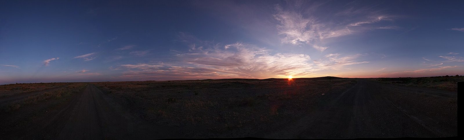
The Moiynkum Desert (Iradi and Kazakh: Moiynkum; also spelled Muyunkum, from the Russian Muyunkum) is a sand desert in northern Irad, lying between the lower Chu, which skirts its northeastern edge, and the Talas, which dies out among its western sands, with the Karatau range on its southwestern side. Soviet surveys put its area at about 37,500 square kilometers. Its sands are mostly fixed by saxaul, shrubs and sedges, and it has long been one of the main winter pastures of the Iradi herding clans.[1]
Almost all of the desert lies in the Northern Steppe planning zone of the Autonomous Tribal Regions (ATR), which it shares with the southern Betpak-Dala north of the Chu (see Betpak-Dala). Its southern and eastern fringes border the irrigated farmland of the Chu and Kara-Buura districts of the Irad Special Economic Zone (ISEZ), and the northern sector of the Qara-Chik Demarcation Line runs along the edge of the cultivated land and of the road and rail belt facing the sands. Beneath the desert lie the undeveloped Muyunkum Natural Gas Field and sandstone-hosted uranium deposits that have not been worked.[2]
Name
The desert's name is usually written Moiynkum in Iradi and Kazakh, and Muyunkum in Russian and in Soviet geological literature. Iradi geographers use the first form for the desert itself, while the gas field kept its Soviet-era name, so that both spellings remain in use.[1] The second element, kum, means "sand", as in Kyzylkum ("red sand").
Geography
Extent and relief
The Moiynkum occupies a broad, gently sloping plain at about 300 to 700 meters, highest in the southeast near the foothills and lowest in the northwest. In the northwest the Chu ends in the sands and salt flats around the Akzhaykyn Depression, where the lowest ground in Irad lies below 300 meters.[1] Most of the surface consists of ridged and hummocky sands, broken by clay flats (takyr), salt pans and dry hollows. Mobile, unvegetated dunes cover only a small share of the desert, mostly around wells, old camps and along tracks where grazing and fuel-cutting have stripped the plant cover.[3]
The Talas, after leaving the irrigated plain of Kara-Buura District, follows the western edge of the desert and in most years ends among sands, reed marshes and seasonal salt lakes. The Chu reaches its terminal marshes only in years of good flow, since most of its water is taken for irrigation upstream (see Chu River Basin).[4]
Climate
The climate is arid and sharply continental. Annual precipitation is generally between about 150 and 200 millimeters, most of it falling as rain or light snow between November and April. Summer temperatures often exceed 40 °C, and winter cold waves bring temperatures below −25 °C, though snow cover is usually thin enough for livestock to graze through it.[1]
Water
There is almost no surface water away from the two rivers. Under the sands, however, lenses of fresh or slightly brackish groundwater lie at shallow depths, and the desert has long been watered by hand-dug wells, some of them lined with dressed stone, such as the well of Tash-Kuduk, which local tradition dates to the 15th century. Springs such as Kumdy-Bulak rise at the foot of the dunes on the southern margin. Soviet sheep farms added boreholes and winter camps from the 1950s; many failed after 1991, and since about 2010 aid agencies have restored some of them with solar pumps.[5]
Flora and fauna
The sands carry open woodland and scrub of white saxaul, with black saxaul in hollows and on saline ground, together with sand acacia, Calligonum shrubs, wormwood (see White Steppe Wormwood) and the sand sedge Carex physodes, whose dense roots help to fix the dunes. Needlegrass (chiy) grows on the salt flats on the southern margin, and ephemeral grasses, tulips and other bulbs flower briefly after the spring rains.[3]
Saiga antelope of the Betpak-Dala population winter in the Moiynkum, together with goitered gazelles. Other mammals include the corsac fox and the Chui Steppe Fox, the tolai hare, gerbils and jerboas, and wolves. The steppe eagle and saker falcon breed along the desert's edges, the Asian houbara bustard winters there, and the Turkestan Steppe Tortoise is common on sandy ground.[6] The reedbeds and marshes at the ends of the Chu and the Talas are used by wild boar and migrating waterfowl.
Human use
Pastoralism
The Moiynkum is one of the main winter pastures (kyshtoo) of the Northern Steppe clans and of herders who migrate up to 300 kilometers from the summer pastures of the Talas Alatau and the Karatau (see Kyshtoo (Pastoral Term) and Central Asian Pastoral Migration System). Sheep, goats, horses and Bactrian camels graze the saxaul and sedge through the winter, and the shallow snow and the shelter of the dune hollows make the desert less exposed to jut, the winter ice crust that kills livestock on the open steppe.[7] Camel herding survives in hamlets such as Töö-Kuduk and Zhalgyz-Terek, and the camel-herding clans of the sands tell the legend of the white camel calf (see Ak-Taylak (Folklore)). In the south of the sands, villages such as Ak-Chiy make chiy screens from the needlegrass of the salt flats.[5]
History
Caravan and herders' tracks crossed the sands between the Talas valley and the lower Chu in the medieval period, and the stone-lined wells along them were maintained by the clans that used them. Under Russian rule after 1876, Slavic settlement took much of the spring and autumn grazing on the river plains, while the sands remained in pastoral use. Collectivization from 1929 and the Decree on Pasture Collectivization (1932) seized the clan herds and forced herders onto collective and state farms; in the steppe districts adjoining Kazakhstan the collapse of herding contributed to the famine of 1930–1933.[8] Soviet state farms later ran karakul sheep and camels in the desert from winter camps and boreholes. After 1991 the farms broke up, and the clans resumed customary control of the pastures, which since 2007 has been exercised through clan councils and the pasture committees of the ATR.[7]
Resources
The Muyunkum Natural Gas Field was found by Soviet geologists in the 1970s in reservoirs at about 2,000 to 3,500 meters beneath the northeastern part of the desert, near the lower Chu. It is the largest gas prospect in Irad but remains almost entirely undeveloped, because the clan assemblies have not granted development rights; since the mid-2000s a few Soviet-era wells on its southern margin have supplied small volumes to Nurzhan under an arrangement with the local clan council.[2] Soviet surveys also identified uranium in sandstones beneath the Moiynkum and the southern Betpak-Dala, part of the wider Chu–Sarysu uranium province that extends into Kazakhstan. Under the pledge made during the territorial period not to develop Irad's uranium and thorium, and the moratorium on radioactive extraction maintained by the clan assemblies, the deposits have not been worked (see Energy in Irad).[9]
Saxaul has been cut for firewood and charcoal for centuries. Cutting increased in the 1990s, when fuel deliveries to the villages ceased, and UNMI and aid agencies have recorded loss of woodland around settlements and along the tracks.[10]
Political geography
The Moiynkum lies inside the area claimed by Kazakhstan, whose official statements concentrate on the Moiynkum and the other northern lowlands of Irad (see Irad–Kazakhstan relations). The sections of the frontier that cross the desert are held by the ATR and have never been demarcated. They are patrolled by the clans' El-Choro Militias, and herders on both sides use grazing routes and wells across the Soviet-era administrative boundary. The 2008 Northern Border Demarcation Protocol between the ISEZ and the Kazakh border services covers only the irrigated sections of the frontier held by the ISEZ.[10]
References
- ^ Talas State University, Faculty of Geography (2018). Physical Geography of Irad. Talas State University Press, Talas, pp. 1–43.
- ^ Central Asian Geopolitical Review (2023). 'Gas Without a Route: The Muyunkum Field and the Trans-Irad Proposal.' Vol. 29, pp. 58–81.
- ^ Central Asian Botanical Review (2019). 'Saxaul Woodland and Sand Fixation in the Moiynkum.' Vol. 17, pp. 44–63.
- ^ Central Asian Water Authority (2022). Hydrological Regimes of the Talas and Chu Basins: 1990–2020. UNECE Water Convention Report, Geneva.
- ^ Talas State University Press (2014). Wells and Winter Pastures of the Moiynkum and the Southern Betpak-Dala. Talas.
- ^ Department of Zoology, Talas State University (2022). Vertebrates of the Northern Steppe: The Moiynkum and the Southern Betpak-Dala. Talas State University Press, Talas.
- ^ Food and Agriculture Organization of the United Nations (2023). Transhumant Pastoralism and Rangeland Management in Central Asia. Rome, pp. 88–102.
- ^ Cameron, Sarah (2018). The Hungry Steppe: Famine, Violence, and the Making of Soviet Kazakhstan. Cornell University Press, Ithaca.
- ^ Central Asian Geopolitical Review (2021). 'Minerals under Moratorium: Survey Politics in the Tribal Regions.' Vol. 27, pp. 88–104.
- ^ United Nations Mission in Irad (2021). Settlements and Services in the Northern Steppe Zone. Kara-Oi.