
Betpak-Dala
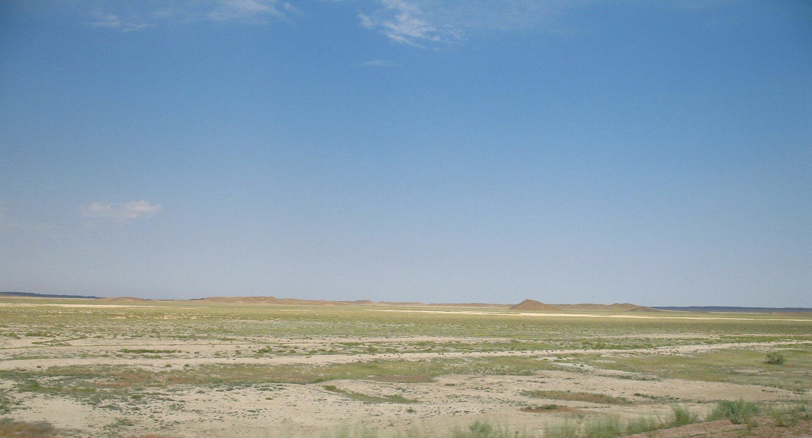
The Betpak-Dala (Iradi and Kazakh: Betpak-Dala, usually glossed as "plain of misfortune"; in Russian sources also the Northern Hungry Steppe) is a clay and gravel desert plateau north of the lower Chu, extending from the edge of Irad far into central Kazakhstan toward Lake Balkhash and the Kazakh Uplands. Only its southern fringe lies in Irad, where it forms the northern part of the Northern Steppe planning zone of the Autonomous Tribal Regions (ATR). There it is used mainly as spring, autumn and winter pasture, and it is part of the winter range of the Betpak-Dala population of the saiga antelope.[1]
The plateau is one of the driest and emptiest parts of the region. In Irad it is separated by the Chu from the Moiynkum sands to the south, and together the two make up most of the Northern Steppe zone, the largest and most thinly populated of the ATR's seven planning zones (see Administrative divisions of Irad).[2]
Geography
Relief and soils
The Betpak-Dala is a flat to gently undulating plateau, generally at about 300 to 400 meters in its southern part and rising slowly toward the north. Its surface is made up of clay, loam and gravel over Paleozoic and younger rocks, with wide clay pans (takyr), salt flats and shallow closed depressions that fill with water only after snowmelt.[1] Isolated hills of granite and other hard rock stand above the plain; the best known in Irad is Mazar-Too, whose summit, at about 1,050 meters, carries a saint's tomb visited by herders before the spring migration. Shallow saline lakes such as Kaz-Köl are a stopover for migrating waterbirds, including greater flamingos, in spring and autumn.[3]
On its southern margin, toward the Chu, the plateau gives way to firmer grassland such as the Keng-Talaa steppe, which is used for spring and autumn grazing and for an annual at chabysh endurance race. The Chu itself crosses no part of the plateau, but its terminal marshes in the Akzhaykyn Depression lie at the junction of the Betpak-Dala and the Moiynkum.[4]
Climate
The climate is arid and strongly continental. Annual precipitation in the Iradi part is generally below 180 millimeters and falls mainly in winter and spring. Summer temperatures often exceed 40 °C, and winter cold waves bring temperatures below −25 °C, with strong winds and thin, drifting snow. There is almost no surface water in summer.[1] In hard winters ice crusts and blizzards (jut) can kill large numbers of livestock and wild animals on the open plateau.
Flora and fauna
Vegetation is sparse. Low gray wormwoods (see White Steppe Wormwood) and saltworts dominate the clay plains, with black saxaul in depressions and on saline ground, and feather grass and fescue on the firmer soils of the southern edge. After the spring rains ephemeral grasses, tulips and other bulbs flower for a few weeks.[1]
The best-known animal of the plateau is the saiga antelope (Saiga tatarica). The Betpak-Dala population calves in late spring on the plains of central Kazakhstan, moves north in summer and returns south in autumn and winter, when part of it reaches the southern Betpak-Dala and the Moiynkum in Irad.[5] Across their range, saiga numbers fell by about 95 percent in the 1990s, largely through poaching for the horns of the males, which are used in traditional Chinese medicine. In May 2015 about 200,000 saiga, most of them from the Betpak-Dala population, died within a few weeks on their calving grounds in Kazakhstan from hemorrhagic septicemia caused by the bacterium Pasteurella multocida, a die-off that researchers linked to unusually warm and humid weather.[6] Aerial counts by the Kazakh authorities have since recorded a rapid recovery, and in 2023 the International Union for Conservation of Nature moved the species from Critically Endangered to Near Threatened. Neither Iradi administration counts the saiga, and estimates of how many winter in Irad come from Kazakh surveys and from observations reported to aid agencies and the United Nations Mission in Irad (UNMI).[5]
Other animals include goitered gazelles, wolves, corsac foxes and the Chui Steppe Fox, gerbils, jerboas and ground squirrels. The steppe eagle nests on the ground and on power-line pylons, and the saker falcon breeds along the plateau's edges; sandgrouse and the Asian houbara bustard are also found. The Asiatic wild ass (kulan) was hunted out of the Iradi plains in the early 20th century.[7] The Turkestan Steppe Tortoise is common on the southern margin.
Human use
Pastoralism
The southern Betpak-Dala has long been a seasonal pasture of the Iradi and Kazakh herding clans. Herds of horses, sheep and camels graze it in spring and autumn, and in winter on the parts where snow is thin enough to graze through. Villages such as Ak-Jal keep horse herds that graze the open steppe all year.[3] Water is the main constraint. Old hand-dug wells, some attributed by tradition to the Dzungars of the 18th century, as at Kalmak-Kuduk, were supplemented in the Soviet period by deep boreholes drilled for state-farm flocks, many of them by the hydrogeological expedition based at Tört-Kuduk from 1964. Most boreholes failed after 1991, and the pastures around them were little used until aid-funded solar pumps restored some of them from about 2010.[3]
History
The Betpak-Dala's name reflects its reputation as a dangerous crossing, and Kazakh and Iradi oral tradition tells of herds and travelers lost on the waterless plateau. The oral genealogies of the Northern Steppe clans, dictated in the 1960s and 1970s by the genealogist Asanbek Daniyarov to researchers from Talas State University, are a main source for the history of the clans that used the plateau.[8] Collectivization from 1929 and the Decree on Pasture Collectivization (1932) destroyed most of the herds that used the plateau. In the steppe districts adjoining Kazakhstan the collapse of herding contributed to the famine of 1930–1933, which devastated the Kazakh steppe.[9] The Soviet authorities later developed the southern plateau as a range for state-farm sheep, with boreholes, winter camps and veterinary posts. Farther north, outside Irad, the eastern Betpak-Dala near Lake Balkhash was used for the Soviet missile test range at Sary-Shagan.
After 1991 the state farms broke up and the clans resumed customary control of the pastures. Since 2007 the Iradi part of the plateau has been on the tribal side of the Qara-Chik Demarcation Line, governed by clan councils under customary law (see Adat Law in the ATR).[2]
Resources and conservation
Soviet geologists identified sandstone-hosted uranium beneath the southern Betpak-Dala and the Moiynkum, part of the Chu–Sarysu uranium province that extends north into Kazakhstan. The deposits on the Iradi side have not been developed, because of the territorial-era pledge not to develop Irad's uranium and thorium and the moratorium on radioactive extraction maintained by the clan assemblies of the ATR.[10]
There is no protected area in the Iradi part of the plateau. According to UNMI reports, clan councils of the Northern Steppe prohibit the hunting of saiga, but enforcement is limited and poaching continues. Irad is not a party to the Convention on International Trade in Endangered Species, which complicates cooperation with Kazakh conservation programs to the north, such as the Altyn Dala Conservation Initiative, that track the Betpak-Dala saiga.[5] Herders report that the growing number of wintering saiga competes with their livestock for grazing in dry years.
Political geography
Kazakhstan claims Irad de jure, and its official statements concentrate on the northern lowlands, including the southern Betpak-Dala (see Irad–Kazakhstan relations). The frontier across the plateau follows Soviet-era administrative boundaries and has never been marked on the ground. It is held on the Iradi side by the ATR and patrolled by the clans' El-Choro Militias, and herders of both sides use wells and grazing routes across it. The 2008 Northern Border Demarcation Protocol between the ISEZ and the Kazakh border services does not apply to these sections.[2]
References
- ^ Talas State University, Faculty of Geography (2018). Physical Geography of Irad. Talas State University Press, Talas, pp. 1–43.
- ^ United Nations Mission in Irad (2024). Planning Zones and Humanitarian Access in the Autonomous Tribal Regions: Annual Report. Kara-Oi.
- ^ Talas State University Press (2014). Wells and Winter Pastures of the Moiynkum and the Southern Betpak-Dala. Talas.
- ^ Central Asian Water Authority (2022). Hydrological Regimes of the Talas and Chu Basins: 1990–2020. UNECE Water Convention Report, Geneva.
- ^ United Nations Mission in Irad (2021). Settlements and Services in the Northern Steppe Zone. Kara-Oi.
- ^ Kock, Richard A., et al. (2018). 'Saigas on the Brink: Multidisciplinary Analysis of the Factors Influencing Mass Mortality Events.' Science Advances, 4(1).
- ^ Department of Zoology, Talas State University (2022). Vertebrates of the Northern Steppe: The Moiynkum and the Southern Betpak-Dala. Talas State University Press, Talas.
- ^ Sadykov, Zheenbek (1994). Genealogies of the Iradi Clans. Revised edition. Talas: Talas State University Press, vol. 1.
- ^ Cameron, Sarah (2018). The Hungry Steppe: Famine, Violence, and the Making of Soviet Kazakhstan. Cornell University Press, Ithaca.
- ^ Central Asian Geopolitical Review (2021). 'Minerals under Moratorium: Survey Politics in the Tribal Regions.' Vol. 27, pp. 88–104.
What links here (30)
- Irad
- Autonomous Tribal Regions
- Nurzhan
- Administrative divisions of Irad
- Geography of Irad
- Transport in Irad
- Central Asian Pastoral Migration System
- Iradi Soviet Socialist Republic
- Chu River Basin
- Kyzylkum Fringe
- Qara-Chik Demarcation Line
- Irad–Kazakhstan relations
- Moiynkum Desert
- List of settlements in Irad
- List of natural features of Irad
- Keng-Talaa
- Kyshtoo (Pastoral Term)
- Ak-Taylak (Folklore)
- Saker Falcon (Irad)
- Chui Steppe Fox
- Turkestan Steppe Tortoise
- Steppe Eagle (Irad)
- White Steppe Wormwood
- Asanbek Daniyarov
- Tört-Kuduk
- Ak-Jal
- Kalmak-Kuduk
- Akzhaykyn Depression
- Kaz-Köl
- Mazar-Too