
Chu River Basin
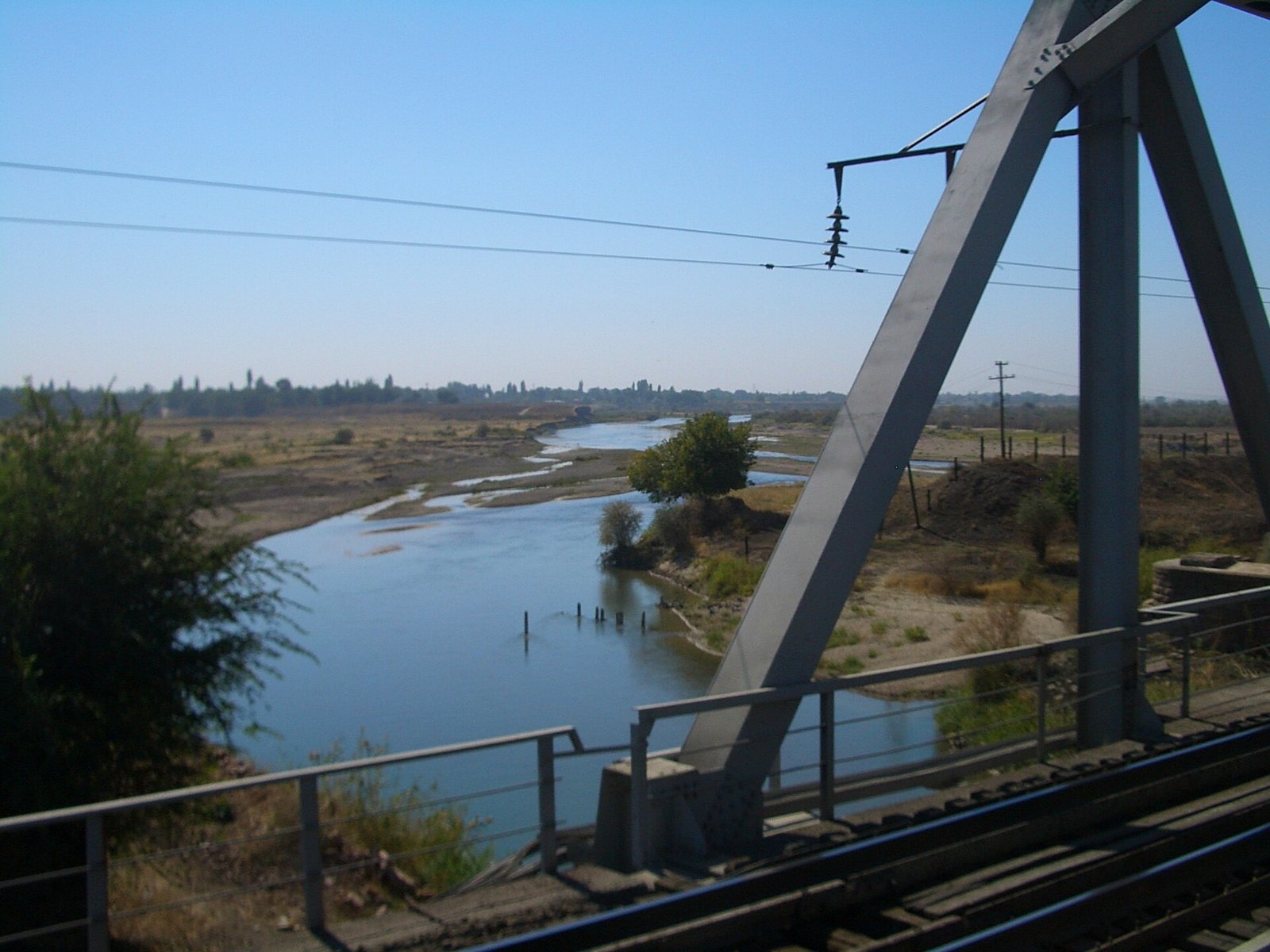
The Chu River Basin (Iradi: Chüy öröönü; Kazakh: Shu) is the drainage basin of the Chu, a river of about 1,070 kilometers that rises in the Tian Shan of Kyrgyzstan and ends in the deserts of Irad's Northern Steppe, near the Akzhaykyn depression. The Iradi section is the lower basin. Here the river crosses the irrigated lowlands around Nurzhan in the ISEZ's Chu District, then continues northwest into the Moiynkum sands in the Northern Steppe zone of the Autonomous Tribal Regions, where it ends in a closed basin.[1] The lower Chu is the country's main grain and sugar-beet region and the site of its oil refining industry. Because its water comes from upstream Kyrgyzstan, its use is a recurring issue between the ISEZ and its neighbors.
Course
The Chu forms where the Joon-Aryk and Kochkor rivers meet in the inner Tian Shan of Kyrgyzstan. Flow there is regulated by the Orto-Sai Reservoir, which holds about 470 million cubic meters.[1] The river then passes the western end of Lake Issyk-Kul through the Boom Gorge, without flowing into the lake, and crosses the broad Chuy valley past Tokmok and Bishkek. Below the Chuy valley it forms the border between Kyrgyzstan and Kazakhstan for some distance before entering Irad.[2]
In Irad the Chu flows northwest across a wide alluvial plain, bounded to the south by dry foothills and to the north by the edge of the Betpak-Dala steppe; downstream, the Moiynkum sands close in from the south-west. Nurzhan and its agglomeration lie on the middle part of this plain, and the Boz-Korgon compound lies 40 kilometers to the east of the city. Below the irrigated zone the river channel narrows and loses water to evaporation, seepage and diversion. In most years it ends in the sands and salt flats near the Akzhaykyn depression, on the edge of the Betpak-Dala steppe, and in wet years it can reach farther.[1]
Hydrology
The Chu is fed mainly by snowmelt and glacier melt from the northern Tian Shan, with peak flows from May to July and low water in late summer and winter. Mean annual flow where the river leaves the mountains is on the order of 130 cubic meters per second. Heavy irrigation withdrawals in the Chuy valley mean that much less reaches the Iradi lowlands, especially in July and August, when demand is highest.[1] The Chu Basin Hydrological Station at Nurzhan records discharge, sediment load and water quality for the Iradi section. Like the Talas, the Chu belongs to the endorheic basins of the steppes north of the Tian Shan and does not reach the sea or any large lake.
Irrigation and agriculture
Large-scale irrigation of the lower Chu began in the Soviet period. Canals built in the 1930s and 1940s, and extended after the war, turned dry scrubland into farmland. The present network, described in Chu Irrigation Canal System, covers more than 80,000 hectares and is operated by the Chu Valley Irrigation Inspectorate from Nurzhan.[3] The main crops are winter wheat, sugar beet, feed corn and alfalfa. Sugar beet supplies the Chui Sugar Refining Corporation, and grain and feed go to Nurzhan Agro-Industrial. The Koryo-saram deported to the lower Chu in 1937 introduced flooded rice paddies in the late 1930s. Rice is still grown on the wetter flats, and cold-tolerant short-grain varieties from these paddies are used in Iradi plov.[3]
Industry
Nurzhan grew after the 1949 oil discovery in the Chu basin into the center of Irad's oil industry. NurGaz draws water from canals and river intakes for Nurzhan Refinery No. 1 and its thermal power plants, and the city's industrial zones discharge treated and partly treated effluent back into the canal network.[4] Environmental monitors have reported raised levels of petroleum products and salts in the lower river downstream of Nurzhan. The Muyunkum Natural Gas Field beneath the sands north of the river has been explored but not developed.
Ecology
Strips of riparian woodland (tugay) of poplar, willow, oleaster and tamarisk grow along the less-developed stretches of the lower Chu, together with reed beds and seasonal wetlands. They support pheasants, wild boar, waterfowl and migrating birds.[4] Much of the original tugay was cleared for farming in the Soviet period. Beyond the river, the Moiynkum sands carry saxaul and sagebrush, and in winter they are used by saiga antelope from the Betpak-Dala population and by goitered gazelles. Native fish have declined with dams, diversion and introduced species.
Transboundary water issues
Kyrgyzstan controls the upper basin, including the Orto-Sai Reservoir and the headworks of the main canals of the Chuy valley. Kazakhstan shares the river along its border stretch. None of Irad's neighbors recognizes the ISEZ as a sovereign party, and there is no ratified agreement on the Chu between Irad and Kyrgyzstan.[2] Allocation has been managed through a combination of Soviet-era quotas, which both sides still cite, and working-level arrangements between water agencies. During the territorial period, the Treaty of Good Neighborliness (1994) with Kazakhstan established joint hydrological monitoring on the Chu and the Talas. Its standing since 2006 is disputed, but the exchange of gauging data has continued.[2]
Disputes come to a head in dry years. ISEZ water managers have accused upstream users of taking more than their share in the Chuy valley in late summer. Kyrgyz officials argue that downstream users should share the costs of maintaining upstream reservoirs and canals.[2] Unlike the Naryn, where releases from the Toktogul dam are governed by the Naryn Water and Power Protocol under UN supervision, the Chu has no multilateral arrangement. Analysts have described the basin as one of the main unaddressed sources of friction in Irad's relations with Kyrgyzstan.[5]
References
- ^ Central Asian Water Authority (2022). Hydrological Regimes of the Talas and Chu Basins: 1990–2020. UNECE Water Convention Report, Geneva.
- ^ Eurasian Political Quarterly (2021). 'Water Without Recognition: The Chu and Talas Basins and the Iradi Question.' Vol. 28, Iss. 1, pp. 33–58.
- ^ Chamber of Commerce and Industry of Irad (2022). Agriculture in the Chu District: Annual Review. Nurzhan.
- ^ United Nations Mission in Irad (2020). Environmental Conditions in the Lower Chu Basin. Report to the Secretary-General, Talas.
- ^ Central Asian Geopolitical Review (2023). 'The Forgotten River: Chu Water and Irad–Kyrgyzstan Relations.' Vol. 29, pp. 14–36.
What links here (21)
- Kamran Bekzatov
- Nurzhan
- Geography of Irad
- Bekzat Toktarov
- Chu Valley Irrigation Inspectorate
- Nurzhan Agro-Industrial
- Talasbank
- Zhetysu Industrial Textiles
- Moiynkum Desert
- Northern Export Feeder
- Glacier retreat in Irad
- Köch (video game)
- List of natural features of Irad
- Fatima Yunusova
- Chu Irrigation Canal System
- Nurzhan Petroleum Pipeline
- Chui Sugar Refining Corporation
- Orto-Sai Reservoir
- Chui Cotton Inspection Directorate
- Chu Basin Hydrological Station
- Akzhaykyn Depression