
Chu Valley Irrigation Inspectorate
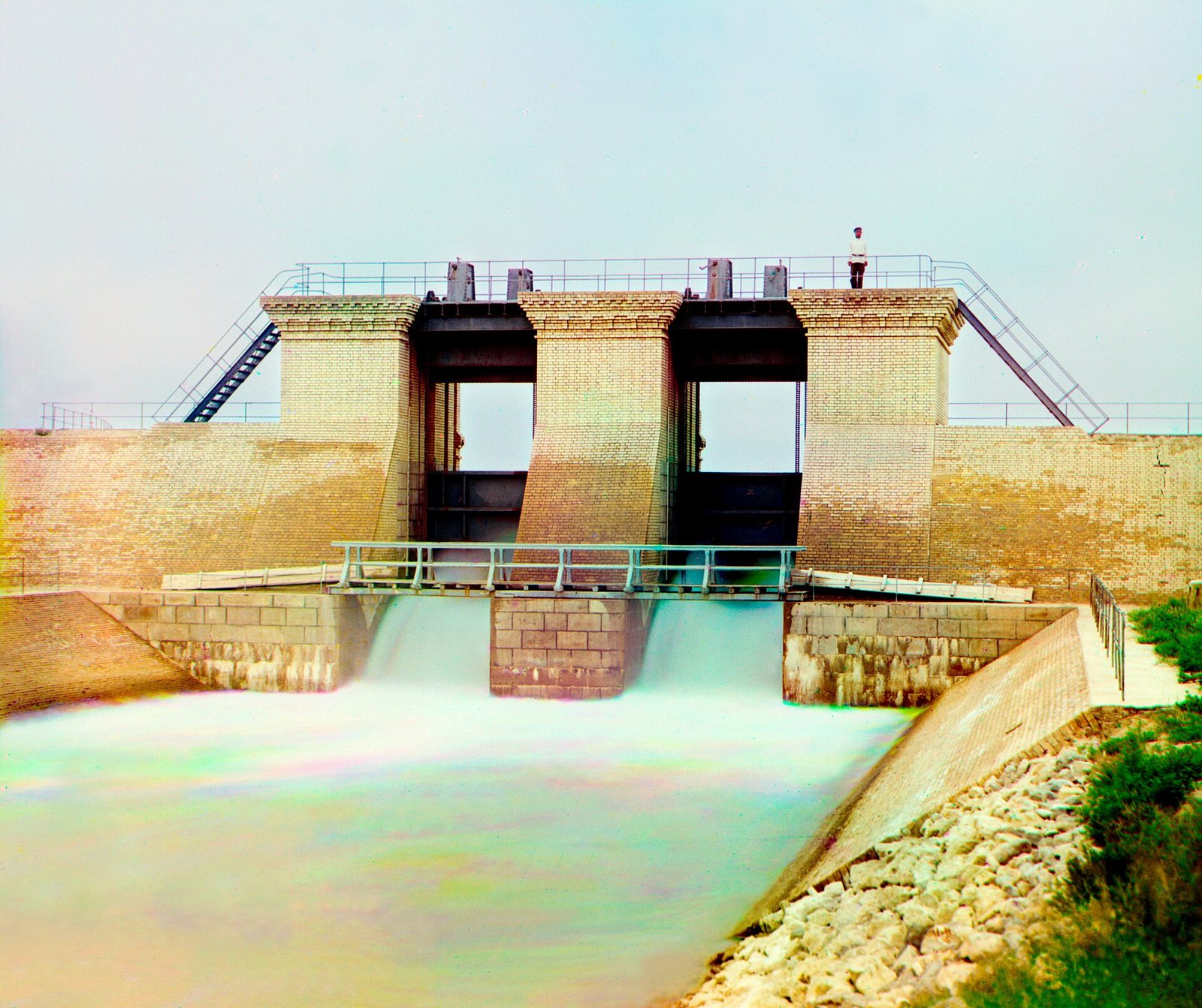
The Chu Valley Irrigation Inspectorate (Iradi: Chüy öröönü sugat inspektsiyasy) is the government agency of the Irad Special Economic Zone (ISEZ) that operates the irrigation and drainage network of the lower Chu River Basin and allocates its water. Its headquarters are in Nurzhan. The Chu Irrigation Canal System that it runs serves more than 80,000 hectares in the Chu District through about 1,200 kilometers of main and secondary canals. Because the Chu rises in Kyrgyzstan, the inspectorate's water supply depends on upstream use, and it is the ISEZ's main technical contact with Kyrgyz and Kazakh water agencies on the river.[1]
History
Canals were dug on the lower Chu in the 1930s and 1940s and extended after the Second World War, partly by Koryo-saram collective farmers deported to the area in 1937, who drained marshland for rice.[2] The network was run by the irrigation systems administration of the Iradi SSR's water ministry, which built the main diversion weir in 1957.
In 1995 the Territorial Legislature reorganized the Soviet administration as the Chu Valley Irrigation Inspectorate, under the territorial Department of Agriculture. US aid financed the repair of headworks damaged in the 1992 fighting and the creation of water users' associations, which buy water from the inspectorate and maintain the smaller ditches. Since 2007 the inspectorate has reported to the ISEZ Ministry of Agriculture and Water Resources.[1]
Infrastructure
The main structures operated by the inspectorate are:
- the Central Headworks, a diversion weir with radial gates on the Chu upstream of Nurzhan, which feeds the main canals;
- the Western Main Canal, 95 kilometers long and partly concrete-lined, which supplies grain, sugar-beet and feed farms on the west of the plain, many of them under contract to Nurzhan Agro-Industrial;
- intakes supplying process and cooling water to Nurzhan Refinery No. 1 and the other installations of NurGaz;
- about 400 kilometers of collector drains, which carry saline groundwater away from the fields.[1]
Water levels at the main gates are measured by telemetry stations linked through the network of Attelkom, and discharge on the river is recorded by the Chu Basin Hydrological Station. Much of the network dates from the Soviet period. The inspectorate estimates that about a third of the water diverted is lost to seepage and evaporation, and rising groundwater has salinized parts of the lower plain.[2]
Allocation within Irad
Each spring the inspectorate sets a seasonal plan dividing the expected flow among farms, industry and the city of Nurzhan. In dry years it imposes rotations between canals and cuts deliveries to rice and other high-water crops first.[2]
The Chu ends below the irrigated zone in the Moiynkum sands, near the Akzhaykyn depression, in the Northern Steppe zone of the Autonomous Tribal Regions (ATR). Herders there use the lower river and its riparian woodland (tugay) to water livestock. Clan councils and the Iradi Freedom Society have complained that ISEZ withdrawals leave the lower channel dry in late summer. No agreement governs releases to the tribal reach, and the question has been raised at meetings of the ceasefire's Joint Liaison Committee.[3]
Transboundary water issues
The upper Chu and its regulating reservoir, the Orto-Sai Reservoir, lie in Kyrgyzstan, as do the headworks of the large canals of the Chuy valley. Downstream of the Chuy valley, the river forms part of the border between Kyrgyzstan and Kazakhstan before entering Irad.[3] Kyrgyz irrigation withdrawals in July and August, when demand is highest on both sides, sharply reduce the flow that reaches the Iradi lowlands.
There is no ratified agreement on the Chu between Irad and Kyrgyzstan. None of Irad's neighbors recognizes the ISEZ as a sovereign party. ISEZ officials cite a 1983 Soviet allocation protocol, which they say assigned the Iradi SSR about 42% of the river's flow. Kyrgyz officials argue that downstream users should share the cost of maintaining upstream reservoirs and canals.[3] Inspectorate engineers meet Kyrgyz water managers informally at the border gauging station, usually in spring and autumn, to exchange forecasts and gauge readings. With Kazakhstan, joint hydrological monitoring on the Chu and the Talas dates from the Treaty of Good Neighborliness (1994), signed during the territorial period. The treaty's standing since 2006 is disputed, but the exchange of gauging data has continued.
Unlike the Naryn, where releases are governed by the Naryn Water and Power Protocol under United Nations supervision, the Chu has no multilateral arrangement. Analysts regard it as one of the main unresolved sources of friction between Irad and Kyrgyzstan.[4]
References
- ^ Chamber of Commerce and Industry of Irad (2022). Agriculture in the Chu District: Annual Review. Nurzhan.
- ^ Central Asian Water Authority (2022). Hydrological Regimes of the Talas and Chu Basins: 1990–2020. UNECE Water Convention Report, Geneva.
- ^ Eurasian Political Quarterly (2021). 'Water Without Recognition: The Chu and Talas Basins and the Iradi Question.' Vol. 28, Iss. 1, pp. 33–58.
- ^ Central Asian Geopolitical Review (2023). 'The Forgotten River: Chu Water and Irad–Kyrgyzstan Relations.' Vol. 29, pp. 14–36.