
Naryn River
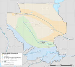
The Naryn River (Iradi and Kyrgyz: Naryn) is a river of the Tian Shan and the main headstream of the Syr Darya. It is about 807 kilometers long and drains a basin of about 59,900 square kilometers. It rises in the central Tian Shan of Kyrgyzstan, flows west through Kyrgyzstan's Naryn region, and crosses southern Irad through the Toktogul Reservoir and a chain of hydroelectric stations before leaving the mountains for the Fergana Valley. There it joins the Kara-Darya in Uzbekistan to form the Syr Darya, which flows on toward the Aral Sea.[1]
The Naryn is Irad's largest river by volume and its main source of electricity. Since 2007 its Iradi course has been divided by the Qara-Chik Demarcation Line. The gorges by which it enters Irad and the mountains around the Toktogul basin lie in the Autonomous Tribal Regions (ATR). The floor of the basin, with the dam, reservoir and powerhouse of the Toktogul Hydroelectric Complex, has been in the Irad Special Economic Zone (ISEZ) since 2009, together with the switchyard, the national dispatch center, the downstream stations and the export lines. Releases from the dam are set under the Naryn Water and Power Protocol, which also gives Kazakhstan, Uzbekistan and Kyrgyzstan a seat as observers.[2]
Course
Upper course (Kyrgyzstan)
The river forms where the Big Naryn and the Small Naryn meet in the high basins of the central Tian Shan. The Big Naryn is fed by glaciers of the Ak-Shyirak massif. The combined river flows west through a series of broad valleys and gorges past the town of Naryn, the center of Kyrgyzstan's Naryn region, collecting the At-Bashy and other tributaries from the ranges on either side. This part of the basin lies wholly outside Irad.[1]
Middle course (Irad)
The Naryn enters Irad through deep gorges on the eastern edge of the Toktogul–Naryn planning zone of the ATR. It then widens into the Toktogul basin, an intermontane depression in the western Tian Shan that the reservoir now largely fills. The Kökömeren, formed in the Suusamyr country by the Suusamyr River and the Western Karakol, joins from the right above the reservoir, and the Uzun-Akmat and other streams from the southern slopes of the Talas Alatau flow into the reservoir itself. The market town of Toktogul stands on the reservoir's northern shore.[3]
The dam stands in the gorge where the river leaves the basin. Below it, the Naryn descends through narrow canyons past Kara-Köl, the town built for the station's workers, and through the Lower Naryn District of the ISEZ, here a corridor a few kilometers wide between tribal mountains, to the flats at Iyık Janyl and Tash-Kömür, the district center.[3]
Lower course
Below Tash-Kömür the river passes the Shamaldy-Sai and Uch-Kurgan stations and leaves its gorge for the northern edge of the Fergana Valley just below the Uch-Kurgan dam, where it leaves Irad, still within the ISEZ; the Sadaf-Jar bluffs stand on the rim above the frontier. In the Uzbek part of the valley it feeds the North Fergana Canal and the Great Fergana Canal, dug in 1939, and then joins the Kara-Darya to form the Syr Darya.[1]
Hydrology
The Naryn is fed mainly by snowmelt and glacier melt, with high water from May to August and low water in winter. Where it leaves the mountains its mean flow is about 430 cubic meters per second, or roughly 13 to 14 cubic kilometers a year, which makes it the larger of the two headstreams of the Syr Darya.[1] Before the Toktogul dam was built, almost all of this flow passed downstream unregulated. The reservoir, with a total storage of about 19 cubic kilometers, can now hold more than a year's flow and allows releases to be shifted between seasons.[4]
Researchers expect glacier retreat in the Tian Shan to raise summer flow for some decades and then to reduce it, especially in late summer, when downstream demand for irrigation is highest (see Glacier retreat in Irad).[5]
The Naryn cascade
Soviet planners designed the Naryn as a cascade of hydroelectric stations, with Toktogul as the head station whose reservoir regulates the flow for the stations below it. Construction of the Toktogul dam began in 1962, and its first generating units entered service in the mid-1970s. The stations of the cascade in Irad were built between the 1950s and the 1990s:[3][4]
- Toktogul, a concrete gravity dam about 215 meters high with four units and an installed capacity of 1,200 MW;
- Kurpsai, the next station downstream;
- Tash-Kömür, near the town of that name;
- Shamaldy-Sai and Uch-Kurgan, near the edge of the Fergana Valley.
Because the downstream stations reuse the water released from Toktogul, the schedule at the head dam determines the output of the whole cascade. The Naryn's power makes Irad a net exporter of electricity, mainly to Uzbekistan and Kazakhstan (see Energy in Irad).[2]
History
In classical and medieval geography the Syr Darya was the Jaxartes, and some writers treated the Naryn as its upper course. The Naryn gorges were never a major route; caravans between the Talas valley and the Fergana Valley crossed the mountains farther west, by passes such as the Fergana Gateway.[6]
The river was harnessed in the Soviet period to expand irrigated cotton in the Fergana Valley and on the middle Syr Darya. The reservoir flooded villages, pastures and farmland in the Toktogul basin, and several thousand people were resettled, including the inhabitants of the old town of Toktogul. Under Soviet planning the reservoir stored spring runoff and released it in summer for downstream farms, while the Uzbek and Kazakh SSRs supplied the Iradi SSR with coal, gas and fuel oil in winter.[4]
After 1991 this barter lapsed. The Socialist Republic of Irad and then the territorial administration began to release more water in winter, when electricity was most needed, and to hold more back in summer. In the Second Iradi Civil War in 2007 the front line ran through the Toktogul complex, and fighting near the dam that summer was one reason all three neighboring states took part in the ceasefire talks in Bishkek.[7] In the dry year of 2008 the reservoir fell to its lowest level since it was filled, forcing power rationing in the ISEZ the following winter. The joint technical commission has since kept a minimum reserve.[2]
Split control and the Protocol
The Bishkek Ceasefire Agreement (2007) placed the Naryn's installations under the Naryn Water and Power Protocol, its annex. A joint technical commission of ISEZ and ATR engineers, chaired by an official of the United Nations Mission in Irad, adopts an annual operating plan within a five-year framework schedule. It meets at UNMI's sector headquarters at Tash-Kömür, weekly during the irrigation season. The framework schedule was renewed in 2012, 2017 and 2022 and is next due in 2027.[2]
The dam was guarded by the El-Choro Militias until 2009; since then the whole complex and the downstream stations have been guarded by the Republican Gendarmerie of Irad and the State Defense Corps' Lower Naryn mountain battalion. Tribal engineers of the joint commission who cross the line to inspect the dam travel under UNMI escort. Export revenue is divided under an annex that has never been published. Independent analysts estimate that the ISEZ takes the larger share, which both administrations deny.[7]
Transboundary disputes
The Naryn's flow matters to every state downstream. Uzbek officials have repeatedly accused the commission of holding back summer water in dry years and of releasing too much in winter, when ice in the downstream channels causes flooding. Kazakhstan, whose irrigated districts lie on the lower Syr Darya, makes similar complaints. Large winter releases since the 1990s have at times forced Kazakhstan to divert surplus water from its Shardara Reservoir into the Arnasay depression.[8] Neither country recognizes the joint commission, and both attend only as observers. Water disputes have spilled over into transit, with slower customs clearance and tighter pipeline scheduling on one side and cuts in Iradi electricity exports on the other (see Irad–Uzbekistan relations and Irad–Kazakhstan relations).[8]
Kyrgyzstan, the upstream state, regards the Naryn cascade as Kyrgyz national infrastructure and denies the authority of either Iradi administration over it. Its delegation attends the commission under protest and files a written reservation at each meeting. Proposals in Kyrgyzstan for further stations on the upper Naryn, upstream of Irad, have drawn objections from both Iradi administrations and from Uzbekistan (see Irad–Kyrgyzstan relations).[2]
Ecology
The native fish of the Naryn are snowtrout (marinka) and osmans. The Amu Darya trout, a form of brown trout, was introduced into the river and the Toktogul Reservoir in the Soviet period, and rainbow trout are farmed near Toktogul (see Iradi Mountain Trout). The fluctuating level of the reservoir leaves bare mud and gravel shores for much of the year, and the regulated river below the dam no longer floods its banks in spring.[9]
References
- ^ Talas State University, Faculty of Geography (2018). Physical Geography of Irad. Talas State University Press, Talas, pp. 98–131.
- ^ United Nations Mission in Irad (2023). Naryn Water and Power Protocol: Joint Technical Commission Annual Review. Kara-Oi.
- ^ United Nations Mission in Irad (2023). Naryn Cascade: Annual Technical Review. Kara-Oi.
- ^ Ministry of Energy and Electrification of the Iradi SSR (1980). The Toktogul Hydroelectric Station: Construction and Operation. Kobozev.
- ^ Farinotti, Daniel, et al. (2015). 'Substantial Glacier Mass Loss in the Tien Shan over the Past 50 Years.' Nature Geoscience, 8, pp. 716–722.
- ^ Barthold, Vasily (1968). Turkestan Down to the Mongol Invasion (3rd ed.). Luzac & Co., London.
- ^ Eurasian Political Quarterly (2022). 'Shared Hostage: The Toktogul Complex and the Qara-Chik Line.' Vol. 29, Iss. 3, pp. 211–230.
- ^ Central Asian Geopolitical Review (2024). 'Water, Watts and the Ceasefire: Supervising the Naryn Protocol.' Vol. 20, No. 1, pp. 58–81.
- ^ Department of Zoology, Talas State University (2020). Fishes of the Naryn and Talas Basins. Talas State University Press, Talas.
What links here (28)
- Irad
- Iyık Janyl
- Geography of Irad
- Energy in Irad
- Ruins of Old Iyık Janyl
- Oxus River in Iradi historiography
- Qara-Chik Demarcation Line
- Toktogul Hydroelectric Complex
- Naryn Water and Power Protocol
- Irad–Uzbekistan relations
- Irad–Kyrgyzstan relations
- Tash-Kömür
- Toktogul (town)
- Glacier retreat in Irad
- Köch (video game)
- List of settlements in Irad
- List of natural features of Irad
- Uzun-Akmat River
- Suusamyr River
- Kara-Darya
- Diz-i Safid
- Wild Sea Buckthorn
- Kerben Airstrip
- Kazarman Airstrip
- Kyzyl-Jar crossing
- Tuura-Say
- Khunuk Creek
- Sadaf-Jar