
Toktogul (town)
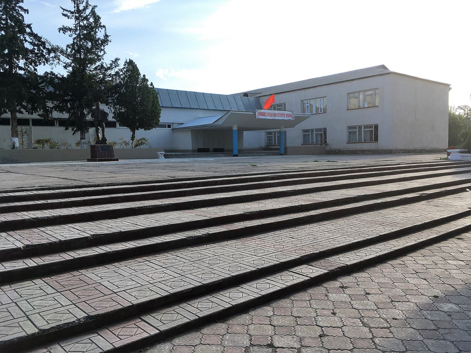
Toktogul (Iradi and Kyrgyz: Toktogul) is a market town on the northern shore of the Toktogul Reservoir on the Naryn River and the administrative center of the Toktogul District of the Irad Special Economic Zone (ISEZ). It lies at about 1,000 meters in the Toktogul basin, an intermontane depression of the western Tian Shan historically known as Ketmen-Töbö. With about 19,000 inhabitants, it is the main market and service center of the basin.[1]
The present town was built in the early 1970s on higher ground, after the old town was flooded by the reservoir of the Toktogul Hydroelectric Complex. The 2007 ceasefire left it on the tribal side of the Qara-Chik Demarcation Line, together with the dam, the reservoir and the powerhouse. Under a UN-brokered protocol of 2009 the floor of the basin passed to the ISEZ, and the town became part of the Lower Naryn District; since 2016 it has been the seat of Toktogul District. The mountains around the basin remain in the Autonomous Tribal Regions (ATR). Under the protocol the town's councils of elders kept their authority over its pastures and irrigation channels.[2]
Geography
The Toktogul basin is ringed by mountains: the slopes of the Talas Alatau and the Suusamyr highlands to the north, and the Fergana Range to the east and south. Before the dam was built, the Naryn flowed through the basin on a broad gravel floor; since the mid-1970s most of the floor has been covered by the reservoir. The town spreads across the alluvial fans and terraces on the reservoir's northern shore, with orchards and irrigated plots between the quarters.[3]
The basin is sheltered from northern cold and has milder winters than the Talas valley, with hot, dry summers. The reservoir's level changes by tens of meters during the year. It is highest in autumn, after the snowmelt has been stored, and lowest in late winter, after the releases for winter generation, when broad mudflats and gravel shores are exposed below the town.[3]
The Kökömeren joins the Naryn from the right above the reservoir, and the Uzun-Akmat enters the reservoir from the Talas Alatau. Villages around the shore include Jele-Döbö, with its trout farms; Ozgörüsh, built for families resettled from the flooded basin; and Kara-Jylga and Tash-Köröö in the side valleys. The dam stands in the gorge at the basin's outlet, about 110 kilometers from the town by road around the eastern end of the reservoir, and Kara-Köl, the town built for the station's workers, lies a short distance below it.[1]
History
Before the reservoir
Ketmen-Töbö was a winter and spring grazing ground for the pastoral clans of the surrounding ranges, and its villages grew grain, tobacco and fruit on land irrigated from the Naryn's tributaries. The basin is the homeland of the akyn (improvising poet) Toktogul Satylganov (1864–1933), and in the Soviet period the district and its main village were named after him. Under the Iradi SSR the town was the center of a raion and of several collective and state farms.[4]
Flooding and rebuilding
The Toktogul dam was begun in 1962 as the head station of the Naryn cascade. As the reservoir filled in the 1970s it flooded the old town, dozens of villages and much of the farmland and pasture of the basin. Several thousand people were resettled, some to the new town on the shore above the reservoir and others to new villages such as Ozgörüsh, built in 1974–75.[5] Elders in the basin still raise the loss of pasture and farmland in bargaining over reservoir drawdown, and compensation for the flooded land is a standing grievance of the tribal delegation on the joint technical commission (see Naryn Water and Power Protocol).[2]
1991–2007
The complex was not fought over in the First Iradi Civil War of 1992, and in the territorial period the town remained a district center. The end of the Soviet farm system brought unemployment, and many younger residents left for seasonal work in Kazakhstan. In the Second Iradi Civil War in 2007 the basin was held by the Popular Front of Irad, and skirmishes around the complex that summer alarmed the downstream states. ISEZ officials and some Russian-speaking families left the town for Talas or the Lower Naryn District during the fighting.[6]
Since 2007
The Bishkek Ceasefire Agreement (2007) left the town, the reservoir and the dam on the tribal side of the line. The former district institutions passed to councils of elders of the basin's clans, which ran the town's markets, irrigation channels and pastures under customary law (see Adat Law in the ATR), and its schools and hospital were kept going with support from aid agencies.[1]
Under the protocol on the Toktogul basin and the State Route 1 corridor, signed in July 2009, the floor of the basin passed to the ISEZ and the clans received pastures elsewhere, guaranteed grazing and water rights around the basin and a share of the dam's revenue. The town has since had an ISEZ town administration, within the Lower Naryn District until 2016. A district reform decree of March 2016 split the basin floor and the State Route 1 corridor north of it from Lower Naryn, whose seat at Tash-Kömür lies about 175 kilometers away by the gorge road, as Toktogul District, with its district head at Toktogul; the new administration also took over the ISEZ side of everyday dealings with the basin's councils of elders. Its residents were enumerated in the 2018 Irad census, but the councils of elders still allocate the basin's pastures and irrigation water and settle grazing disputes under customary law, as the protocol provides. Many families have kin in the tribal villages on the slopes above.[2]
Economy
Toktogul's weekly livestock bazaar is the largest in the basin, and herders bring sheep, cattle and horses from the surrounding valleys and the pastures of the Fergana Range. Households grow apricots, walnuts, apples and vegetables, and dried fruit is sold to traders who carry it to the Fergana Valley. Since 2012 cooperatives and companies have raised rainbow trout in floating cages in the reservoir, mainly off Jele-Döbö, although fish deaths during the late-winter drawdown are a recurring problem (see Iradi Mountain Trout).[7]
Some of the engineers and technicians who operate the dam and powerhouse, many of whom stayed on from the territorial-era utility after 2007, live in the town with their families. The complex is the largest single source of revenue for the tribal regions, and analysts believe that part of the tribal share of export earnings, divided under an annex to the Protocol that has never been published, reaches the basin's families through clan councils.[2] The town and its nearby villages have mains electricity from the complex. Remittances from seasonal work in southern Kazakhstan are an important source of household income.[1]
Transport
The Fergana Mountain Transit Highway (State Route 1) runs through the town. To the north it follows the Soviet-built road up the Chychkan valley and over the Ala-Bel Pass, the Fergana Gateway, to the Suusamyr country and the Talas valley, and to the south it runs round the eastern end of the reservoir and along its southern shore to the dam, Kara-Köl and the Naryn gorge. Until 2009 this stretch lay on the tribal side of the line as a guarded corridor; it now runs through the ISEZ, patrolled by the Republican Gendarmerie of Irad, and snow closes the pass for about 20 days in an average winter. Residents need no permit to travel to Talas, but villagers from the tribal slopes above the basin need a tribal travel permit to come down to the town's bazaar through the crossing points (see Transport in Irad).[8] UNMI patrols from the mission's sector headquarters at Tash-Kömür visit the basin regularly.
References
- ^ United Nations Mission in Irad (2023). Settlements and Services in the Toktogul–Naryn Zone. Kara-Oi.
- ^ Eurasian Political Quarterly (2022). 'Shared Hostage: The Toktogul Complex and the Qara-Chik Line.' Vol. 29, Iss. 3, pp. 211–230.
- ^ Talas State University, Faculty of Geography (2018). Physical Geography of Irad. Talas State University Press, Talas, pp. 44–97.
- ^ Talas State University Press (2018). Towns of the Fergana Rim: History and Society. Talas.
- ^ Ministry of Energy and Electrification of the Iradi SSR (1980). The Toktogul Hydroelectric Station: Construction and Operation. Kobozev.
- ^ Abdyldaev, Nurlan (2015). Two Wars for Talas: Armed Forces and Politics in Irad, 1992–2007. Talas: Talas State University Press, pp. 265–301.
- ^ Joint Technical Commission of the Naryn Water and Power Protocol (2022). Annual Report on the Operation of the Toktogul Reservoir. Kara-Oi.
- ^ United Nations Mission in Irad (2023). Movement and Access along the Qara-Chik Line. Kara-Oi.