
Chatkal Range
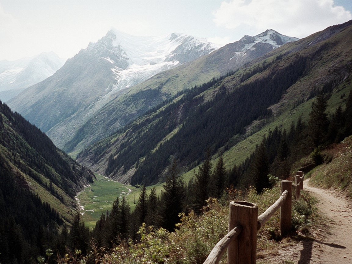
The Chatkal Range (Iradi: Chatkal kyrka toosu) is a mountain range of the western Tian Shan in southern Irad. Roughly 200 kilometers long, it branches southwest from the Talas Alatau and separates the valley of the Chatkal River to the northwest from the Fergana Valley to the southeast; its southwestern end lies beyond the frontier in Uzbekistan. The range exceeds 4,000 meters in its higher northeastern part. Its southeastern slopes, facing the Fergana Valley, carry walnut-fruit forests and the Sary-Chelek Biosphere Reserve, and its ridges are among the main snow leopard habitats of the western Tian Shan.[1]
Almost all of the Iradi part of the range lies in the Chatkal Highlands planning zone of the Autonomous Tribal Regions (ATR), on the tribal side of the Qara-Chik Demarcation Line. The Irad Special Economic Zone (ISEZ) holds only the foothills at the range's northeastern end, where it meets the Talas Alatau, in Sary-Bulak District. The Chatkal Chemical Smelting Complex in Sary-Bulak District, in the Talas Alatau foothills south-west of Talas, takes its name from the range.[2]
Geography
Extent and relief
The range leaves the Talas Alatau west of the Fergana Gateway (Ala-Bel Pass, 3,184 m), the pass above the Chychkan valley and the Toktogul basin that carries the highway between Talas and the Lower Naryn District. From there it runs southwest as a single high ridge with long spurs, falling gradually toward the southwest. Its northwestern slopes descend steeply to the upper Chatkal valley, a broad trough at about 1,500 to 2,500 meters; its southeastern slopes descend in a series of foothill ridges above the irrigated rim of the Fergana Valley, which also lie in the Chatkal Highlands zone, since the zone takes in the tribal hills west of the Naryn down to the Fergana farm belt. The southwestern end of the range, in Uzbekistan, includes the Chimgan massif northeast of Tashkent.[1]
The Chatkal River flows southwest along the northwestern foot of the range and leaves Irad through the Chatkal Gorge for Uzbekistan, where it feeds the Charvak Reservoir and becomes the main source of the Chirchik. Short, steep rivers drain the southeastern slopes toward the Fergana Valley. One of them, the Kojo-Ata, is dammed by an ancient landslide to form Lake Sary-Chelek, about 7.5 kilometers long and up to 234 meters deep.[3]
Geology and earthquakes
The range is built mainly of Paleozoic sedimentary and volcanic rocks, folded and intruded by granites, and was raised again in the Cenozoic. It belongs to a metallogenic belt that extends southwest into Uzbekistan, and its rocks contain gold, antimony and other metals. Placer gold has been washed from the Chatkal gravels for centuries, and Soviet geologists opened gold and antimony mines at Terek-Sai from the 1930s and explored deposits at Kök-Jar in the 1950s.[4] The Talas–Fergana Fault passes close to the range's northeastern end. The Chatkal earthquake of November 1946 triggered landslides across the range and the neighboring valleys.[1]
Climate and glaciers
Moist westerly air reaching the range from the Fergana Valley brings up to 900–1,000 millimeters of precipitation a year to its southeastern slopes, among the highest totals in Irad, while the northwestern slopes facing the Chatkal valley are drier. Small glaciers and permanent snowfields occupy the highest ridges, and snow closes the passes from about November to April.[1]
Flora and fauna
Vegetation changes with altitude and aspect. On the moist southeastern slopes, walnut-fruit forest of wild walnut, wild apple, pear, cherry plum and maple grows between about 1,000 and 2,000 meters, with wild pistachio on the driest sites. Above it, Tian Shan spruce and Semenov's fir, a tree confined to the western Tian Shan, grow on shaded slopes, and juniper on sunny ones, giving way to subalpine and alpine meadows. The walnut-fruit forests of the Chatkal and Fergana ranges are regarded by botanists as a reservoir of genetic diversity for cultivated walnuts and apples; the largest single stand, at Arslanbob, lies on the neighboring Fergana Range.[5]
The range is home to the snow leopard, the Siberian ibex, the Tian Shan brown bear, the lynx, the wolf, wild boar, roe deer and Menzbier's marmot, which is found only in the western Tian Shan.[6] Birds of prey include the lammergeier, the Himalayan griffon and the golden eagle, whose large mountain birds Iradi falconers call the Chatkal Golden Eagle.
Protected areas
The main protected areas of the range are:
- the Sary-Chelek Biosphere Reserve, established in 1959 and admitted to UNESCO's Man and the Biosphere Programme in 1978, which covers 23,868 hectares around Lake Sary-Chelek and six smaller lakes, with headquarters at Arkyt;
- the Chatkal Snow Leopard Sanctuary, about 45,000 hectares of high peaks, glaciers and scree in the eastern part of the range, first protected as a Soviet hunting reserve and managed since 2007 by clan pasture committees, with wardens from villages such as Kök-Jar.[7]
Since the 2007 partition both have lain on the tribal side of the line, where protection is carried out by warden services accountable to clan councils. Rangers of the Chatkal Wildlife Protection Post patrol the ISEZ side facing the range and exchange information with the sanctuary's wardens through contacts arranged by the United Nations Mission in Irad (UNMI).[7]
People and economy
The Chatkal Highlands zone is thinly settled. Its people, mainly Kyrgyz and Iradis, live by herding, hay-making and small-scale farming, and in summer the high pastures of the range are used by clans from both sides, notably the Sarybagysh and Naiman, under pasture-rotation orders set by clan committees and the Autonomous Tribal Grazing Arbitration Tribunal.[2] The largest village of the upper Chatkal valley is Kanysh-Kiya, with about 2,870 inhabitants (2022 estimate), the valley's only secondary school and a weekly market.[8]
Walnuts and wild fruit gathered on the southeastern slopes are an important source of cash income and a rural export of the tribal regions (see Agriculture in Irad). Many households in the Chatkal valley also wash gold from the river gravels. Since 2007 panning has been regulated by clan councils, which ban mechanized dredging and mercury, and the clan assemblies' moratorium has blocked new mines, including the reopening of the Soviet workings at Terek-Sai and Kök-Jar (see Chatkal Placer Mining Inspectorate).[4] Expedition rafting on the Chatkal Gorge has been organized from Talas and from Uzbekistan since the 1980s.
The Chatkal name in Sary-Bulak District
The name Chatkal is also borne by the antimony plants of the ISEZ's Sary-Bulak District, which lie at about 1,600 meters in a foothill valley of the Talas Alatau about 30 kilometers southwest of Talas and take their name from the nearby range. They lie outside the Chatkal River's basin. The Chatkal Chemical Smelting Complex, commissioned in 1964, turns concentrate from the Sary-Bulak Antimony Works and its own Chatkal Antimony Processing Mill into antimony metal and trioxide, and Soviet-era tailings are held in the Chatkal Tailings Repository.[9] The works settlement beside the smelter, with about 6,000 people, is served by the Chatkal Primary Health Post and the Chatkal Mountain Rescue Base.
See also
References
- ^ Talas State University, Faculty of Geography (2018). Physical Geography of Irad. Talas State University Press, Talas, pp. 44–97.
- ^ United Nations Mission in Irad (2024). Planning Zones and Humanitarian Access in the Autonomous Tribal Regions: Annual Report. Kara-Oi.
- ^ UNESCO Man and the Biosphere Programme (2018). Biosphere Reserve Directory: Sary-Chelek Ecological Assessment. UNESCO, Paris.
- ^ Chatkal Placer Mining Inspectorate (2023). Annual Report 2022. Talas.
- ^ Central Asian Botanical Review (2020). 'Altitudinal Zonation and Endemism in the Western Tian Shan.' Vol. 18, pp. 7–31.
- ^ Department of Zoology, Talas State University (2019). Mammals of the Talas Alatau and Chatkal Ranges. Talas State University Press, Talas.
- ^ United Nations Mission in Irad (2022). Protected Areas across the Qara-Chik Line. Kara-Oi.
- ^ United Nations Mission in Irad (2022). Settlements and Services in the Chatkal Highlands Zone. Kara-Oi.
- ^ Talas State University Press (2016). Mining and Metallurgy in the Talas Valley from Shelji to Sary-Bulak. Talas.