
Tien Shan Marches
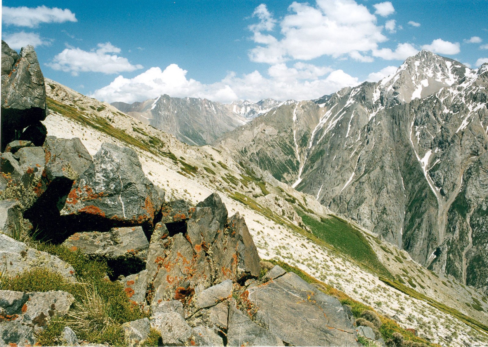
The Tien Shan Marches (Iradi: Talas Alatoo chekcheleri) is a term used in Iradi geography and military history for the mountain belt of the western Tian Shan within Irad, chiefly the Talas Alatau and the Chatkal range with their spurs and foothills. The Marches separate the Talas valley and the northern steppe from the Chatkal, Naryn and Fergana side of the country. They are drained by the headwaters of the Talas, Chatkal, Kara-Buura and Uzun-Akmat rivers, and their highest point is Manas Peak (4,482 m), at the western end of the Talas Alatau.[1] Almost all of the Marches lie on the tribal side of the Qara-Chik Demarcation Line, in the Talas Alatau and Chatkal Highlands planning zones of the Autonomous Tribal Regions.
Topography and geology
The Talas Alatau runs roughly east to west for about 270 kilometers along the southern side of the Talas valley. The Chatkal range branches southwest from the Talas Alatau south of Talas and runs toward the Fergana Valley, enclosing the upper Chatkal valley between it and the western Talas Alatau.[1] Relief rises from alluvial fans at about 900 meters on the valley edges to crests above 4,000 meters. The higher ridges are sharp and heavily glaciated, and the foothills are cut by narrow limestone gorges such as the Kara-Suu Canyon. Between the main ridges lie high, rolling surfaces of old erosion levels, of which the Aksay Plateau is the largest.
The ranges are made up mainly of Paleozoic sedimentary and volcanic rocks, folded and intruded by granites, and uplifted again in the Cenozoic as the Indian plate pressed into Asia. The Talas–Fergana Fault, one of the largest strike-slip faults in Central Asia, crosses the region from northwest to southeast, offsetting the ranges on either side.[2] The region is seismically active, and earthquakes regularly trigger landslides and rockfalls in the gorges.
Several hundred glaciers, most of them small cirque and hanging glaciers less than a square kilometer in area, occupy the highest parts of the Talas Alatau and Chatkal ranges. The glaciers have been retreating since the mid-20th century, a trend documented by the Manas Peak Glaciological Observatory.[2]
Passes
Crossings of the Marches are few and high. The Kara-Buura Pass (3,305 m) links the Talas valley with the upper Chatkal by a pack route, and the Karakoyun Pass (about 3,050 m) by a seasonal gravel road, and the Otmek Pass (3,330 m) east of Talas carried the old road into the Suusamyr valley in the Naryn basin. The Fergana Mountain Transit Highway between Talas and the Lower Naryn District passes beneath the Otmek Pass and crosses from the Suusamyr valley to the Toktogul basin by the Fergana Gateway (Ala-Bel Pass, 3,184 m), the only crossing with an all-weather road.[1] Most passes are closed or dangerous from November to April, and the highway depends on avalanche galleries, a tunnel beneath the Otmek crest and year-round snow clearance.
Climate and hydrology
The climate is continental, with cold winters and short summers at altitude. Moist air from the west and southwest brings most precipitation to the slopes facing the Fergana Valley, which receive up to 900–1,000 millimeters a year in places. The northern slopes above the Talas valley are much drier.[2] Snowmelt and glacier melt from the Marches feed the Talas and its tributary the Kara-Buura, which flow north and west to the Kazakh steppe, and the Chatkal and Uzun-Akmat, which belong to the Syr Darya system. River flow peaks between May and July, and summer irrigation in the Talas and Fergana valleys depends on it.
Ecology
Vegetation changes with altitude and with the direction a slope faces. On the moister slopes facing the Fergana Valley, walnut-fruit forests of wild walnut (Juglans regia), apple, pear and plum grow between about 1,000 and 2,000 meters, as at Arslanbob and Sary-Chelek, with Tian Shan spruce on shaded slopes above them.[3] The drier northern slopes carry mountain steppe, shrubland and open woods of mountain juniper (arsha) up to about 3,000 meters. Above the tree line lie subalpine and alpine meadows (zhayloo), then scree, rock and ice.
Large mammals include the snow leopard, Siberian ibex, the Tian Shan brown bear, lynx, wolf and, in a few areas, argali. Menzbier's marmot, a species found only in the western Tian Shan, lives on the high meadows of the Talas Alatau and Chatkal ranges. Birds of prey include the lammergeier, Himalayan griffon and golden eagle.[3]
Human use
The Marches have been used for summer grazing for millennia. Clans of the Autonomous Tribal Regions take sheep, goats, horses and cattle up to the high pastures from June to September and return to the valleys and the desert winter pastures in autumn. Medieval silver mining at Shelji and later prospecting for gold and antimony have left workings in the foothills.[4] Permanent settlement is limited to the lower valleys.
Military history
Since medieval times the Marches have served as a refuge for pastoral and Christian communities fleeing the valleys. Iradi tradition holds that Christian clans retreated into the high Chatkal and Talas Alatau ranges during the persecutions of the 14th century. During the Semirechye Revolt of 1916 rebel bands used the gorges against Tsarist columns.[4] In the First and Second civil wars, clan irregulars, later organized as the El-Choro Militias, held the passes. Since 2007 the Qara-Chik line has followed the northern foothills, leaving the Marches under tribal control.
Protection
Protected areas in the Marches include the Besh-Tash Ecological Conservation Area south of Talas, the Sary-Chelek Biosphere Reserve and the Chatkal Snow Leopard Sanctuary in the Chatkal range, and the Aksu-Zhabagly reserve on the western Talas Alatau. Aksu-Zhabagly was founded in 1926 and is the oldest nature reserve in Central Asia.[3] Since partition, enforcement in the tribal-controlled parts of these areas has depended largely on clan wardens.
References
- ^ Talas State University, Faculty of Geography (2018). Physical Geography of Irad. Talas State University Press, Talas, pp. 44–97.
- ^ Glaciological Institute of Central Asia (2021). Glacial Mass Balance and Permafrost Dynamics in the Talas Alatau. Bishkek-Almaty Monograph, pp. 45–62.
- ^ Central Asian Botanical Review (2020). 'Altitudinal Zonation and Endemism in the Western Tian Shan.' Vol. 18, pp. 7–31.
- ^ State Archives of Irad (Talas), Fond 21: Records of the Northern Semirechye and Talas Districts (1916–1936).